
[ad_1]
The University of Arizona’s Lunar and Planetary Laboratory (LPL) is using imaging OCR software to create an archive of thousands of images of the moon’s surface taken back in the 1960s by NASA’s exploratory Surveyor missions.
Surveyor missions
The primary goal of the Surveyor programme was to demonstrate the feasibility of landings on the Moon (running from 30 May 1966 to 7 January 1968, there were five successful missions).
Now many of the pictures taken have been fully digitised. Basically, extracting and decoding the original encoded image data, which was optically recorded on each film frame.
Matrox
Which is where Matrox came in. The company tells the story…
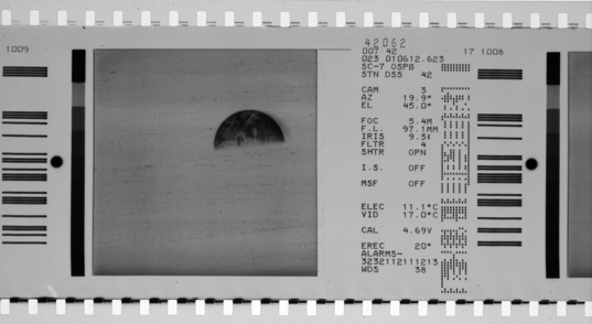
In the 50 years since [Surveyor missions], the computer files and video tape records have long disappeared or become obsolete—the only existing copies of the images are the film rolls.
Many frames from the Surveyor missions had seemingly legible text, which the operators initially thought could easily be read by conventional optical character recognition (OCR) software. They soon discovered that the characters in the text were a dot matrix similar to old printers using a 7×9 teletype-style character, making it a challenge to find an OCR software capable of accurately reading the text fields. A comprehensive OCR solution was needed.
The Stokes Imager used to digitise the original image frames is shown below.
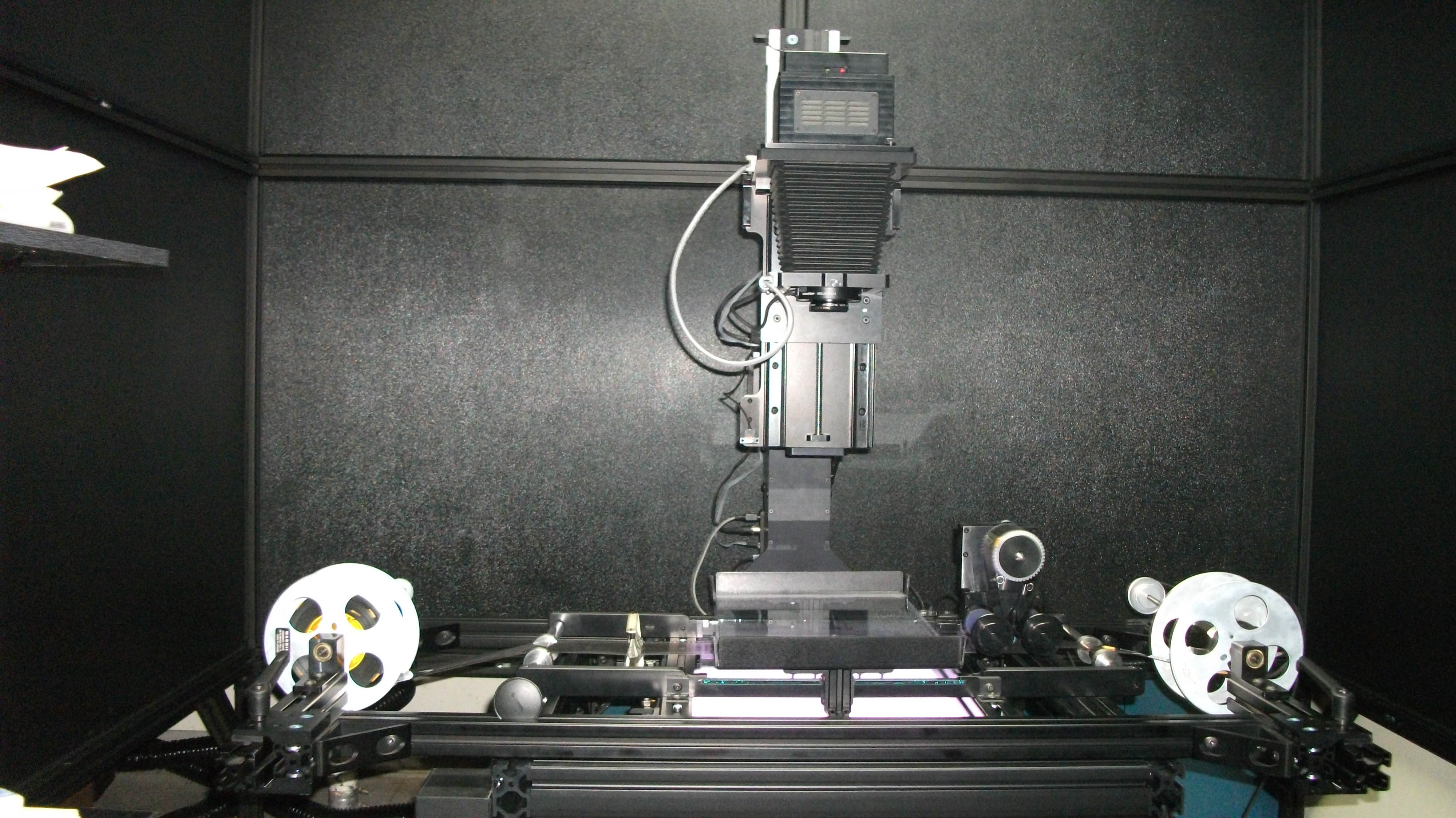
The Stokes Imaging System captured between four and eight frames per minute as high-resolution TIFF images, says Matrox. At the conclusion of the scanning phase, LPL had processed 92,000 individual images.
“Once scanned, Adobe Photoshop and MATLAB software were used to pick out the details and create large composite mosaics from the image files. The process also required manual error checking since the decoding of the dot-field data relied on calibration lookup tables created from the original 1966 pre-launch test data.”
Problems encountered include inconsistent frame spacing as well as frames drifting with respect to the edge perforations…
The team at LPL were unable to determine a consistent film advance, and with each new roll of film, the spacing of the frames and lateral positioning of the image shifted. This resulted in overall images with text in different places, as well as some images tainted with artifacts. Moreover, the data fields have HRT with varying number of characters.
Apparently data from Surveyor 5 has been tackled and the Matrox tool will help during the catalogue and error check of data from Surveyor 6 and 7.
You can read the full case study on the Matrox website.
The archive is intended for inclusion in the NASA Planetary Data System.
Images: Matrox and University of Arizona’s LPL
[ad_2]
Source link