
[ad_1]
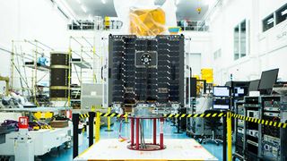
Main image: Earth-i’s orbiting 4K Ultra HD can stream live video of the planet. Credit: Earth-i
What if the images in Google Earth were refreshed not every fews years, but every few seconds. Or just streamed as live video of Earth shot from space? What if the famous Google Street View vehicles weren’t vans, but drones?
All of this will soon be possible, thanks to a 4K Ultra HD camera that can stream full-color video back to Earth from more than 300 miles up. Meanwhile, drones and unmanned aerial vehicles (UAVs) are on the cusp of being able to offer high-resolution close-ups of everything, everywhere. Google Earth Engine has already made satellite imagery available for Earth scientists – is the future for Earth observation real-time video?
The first-ever color video from space
Having launched in January 2018, UK company Earth-i‘s VividX2 satellite began sending back the first full-color video. As well as multi-angle images that construct a 3D model, it has a ‘video staring’ mode; as it passes over at more than four miles per second it constantly reorients its camera to fix on a particular location, producing a two-minute, 50fps video of that location. Each pixel represents 60cm or just under 24 inches.
It can produce real-time video of airport runways, the movements of ships in harbors, and cargo around ports. The images can be used to monitor the exact number of cars on motorways, count how many people are crossing a national border, and even to calculate the real-time power output of a wind farm.

Earth-i’s VividX2 satellite produces two-minute videos at 50fps
(Image: © Earth-i)
Why do we need color video?
“If machine learning algorithms are applied, the addition of color definition offers much improved object recognition and tracking,” says Richard Blain, chief executive at Earth-i. “Color also enables much improved change detection between different dates – particularly when the image or video acquisition conditions are not perfect.”
Although it’s already functioning, the VividX2 satellite is actually a prototype for the company’s upcoming Vivid-i Constellation. “Earth-i will initially launch 15 satellites in batches of five,” says Blain. “This will give a daily revisit capability for any location on Earth at a minimum of three different times per day once the constellation is complete.”
VividX2 is a prototype for the company’s Vivid-i Constellation. Credit: Earth-i
(Image: © Earth-i)
This is about big data
“Earth Observation data is becoming a major driver in the so-called Fourth Industrial Revolution – the era of Big Data analytics,” says Blain, who adds that AI is critical in analyzing the petabytes of data. “Location data is the foundation on which many big data solutions are being built to drive better decision-making and policy thinking the world over.”
There’s now a lot of Earth Observation data around. As well as a plethora of commercial satellite datasets, free Earth Observation data is provided by the European Commission’s Copernicus programme and the US Landsat satellites.
Earth Observation: Planet
Earth-i isn’t the only company focused on producing real-time satellite imagery. Planet Labs has 200 satellites in orbit including 175-pluse Doves, 13 SkySats and five RapidEye satellites, which have lately been used to identify changes at weapons facilities in Iran and North Korea, and even to track migratory birds. However, it only produces still black-and-white images, albeit at up to 72cm-per-pixel resolution images. Planet uses 13 SkySat satellites, some which it acquired from Google’s Terra Bella. Google is now a major investor in Planet, as well as a customer.
Earth Observation: Urthecast
Having streamed color video from the International Space Station in 2015, Vancouver, Canada-based Urthecast is planning to launch 16 satellites – eight optical and eight radar (the latter to overcome cloud cover), orbiting in pairs – to form its OptiSAR constellation. Crucially, these satellites will also be orbiting on two different planes, so will create unique 3D or ‘geospatial’ images and 30fps video of the entire planet’s landmass, Antarctica excluded, refreshed once each day. 3D is important because Earth is covered in mountains, valleys and cities, so oblique views are crucial.
However, that UrtheDaily service won’t begin until Urthecast launches its satellites, which it expects to do in 2019.
Is a live, real-time Google Earth technically possible?
Using satellites and/or drone technology, would it be possible to have a Google Earth-like service that not only used images that updated in real time, but also included live streaming video?
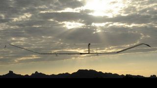
HAPS like the QinetiQ Zephyr-7 are a ‘missing link’ between drones and satellites. Credit: Airbus
(Image: © Airbus)
“From a technical point of view that is entirely possible,” says Blain, although the nature of orbital imagery does come at a high cost. “A low Earth orbit optical satellite cannot be stationary over one location, so to do persistent monitoring globally over a particular area, you’d need close to 1,000 satellites,” he says, “and many, many more drones or High Altitude Pseudo-Satellite (HAPS) to add the depth of data needed to achieve a constant ‘live’ picture of Earth.”
A HAPS is a platform that floats or flies at high altitude like an airplane, about 12 miles up, but operates more like a satellite; two of the major HAPS are the solar-electric QinetiQ Zephyr-S and Stratobus.
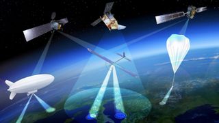
A live Google Earth-type service would require thousands of satellites and HAPs, and likely millions of drones. Credit: ESA Earth Observation Graphics Bureau
(Image: © ESA Earth Observation Graphics Bureau)
What about ‘drone maps’?
While satellites get the big picture, drones can capture the kind of detail needed for close-ups, such as those in the Google Maps Street View. Street View itself still has a lot of work to do in Africa, the Middle East and China, as Google’s own map demonstrates. Can drones help?
“Plan a flight with DroneDeploy from your iOS device, take off with your DJI drone, and see maps render on-screen during flight,” says Mike Winn, CEO and co-founder of drone software company DroneDeploy. “Your completed map is ready before the drone lands.”
DroneDeploy’s ‘Live Map’ software is the first capable of generating drone maps in real time. Farmers use the maps for analyzing the growth and health of crops, while construction companies can monitor the progress of a job site.
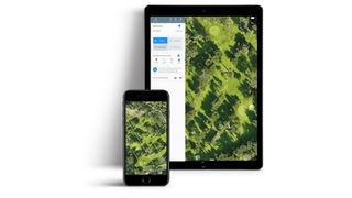
DroneDeploy’s ‘Live Map’ software generates drone maps in real time. Credit: DroneDeploy
(Image: © DroneDeploy)
The real-time future
The more satellites that are launched to cover the gaps in coverage, the better, but Earth-i’s move to video rather than stills is an exciting advance. “Wherever the asset, wherever the issue, wherever an emergency, Earth-i will be able to take color video from space every day, multiple times of day,” says Blain. “That is a major step forward towards near real-time Earth observation, and a significant leap forward from what has previously been possible.”
Space technology is advancing so quickly that it’s now possible for software like Google Earth to offer imagery that is just a few days, hours or even minutes old. “There is no reason companies should have to wait hours or even days for aerial insights, or operate with outdated satellite imagery,” says Winn. “As we see an increasing number of satellites, the ability to bring down data in real time will become more affordable and accessible for those who need it. Real time is the future.”
Do we need a live, real-time Google Earth?
Are instant aerial insights important? It may be possible, albeit complex, but does anyone actually need ‘eyes everywhere’ persistent monitoring? After all, we live on a mostly blue planet.
“More than 70% of the Earth is covered by oceans, and while Earth orbit satellites are increasingly playing their part in maritime surveillance, the oceans perhaps do not need such high persistent monitoring,” says Earth-i’s Blain. “Some locations are just more important than others, and this is what will drive the extent to which persistent monitoring of Earth is developed.”
So the future is probably demand-based, with more and more satellites able to provide color video from space of specific assets or emergencies. “For these constellations to be commercially viable there must be customers with Earth observation needs that require all of this data to be collected from space,” adds Blain.
TechRadar’s Next Up series is brought to you in association with Honor

[ad_2]
Source link